

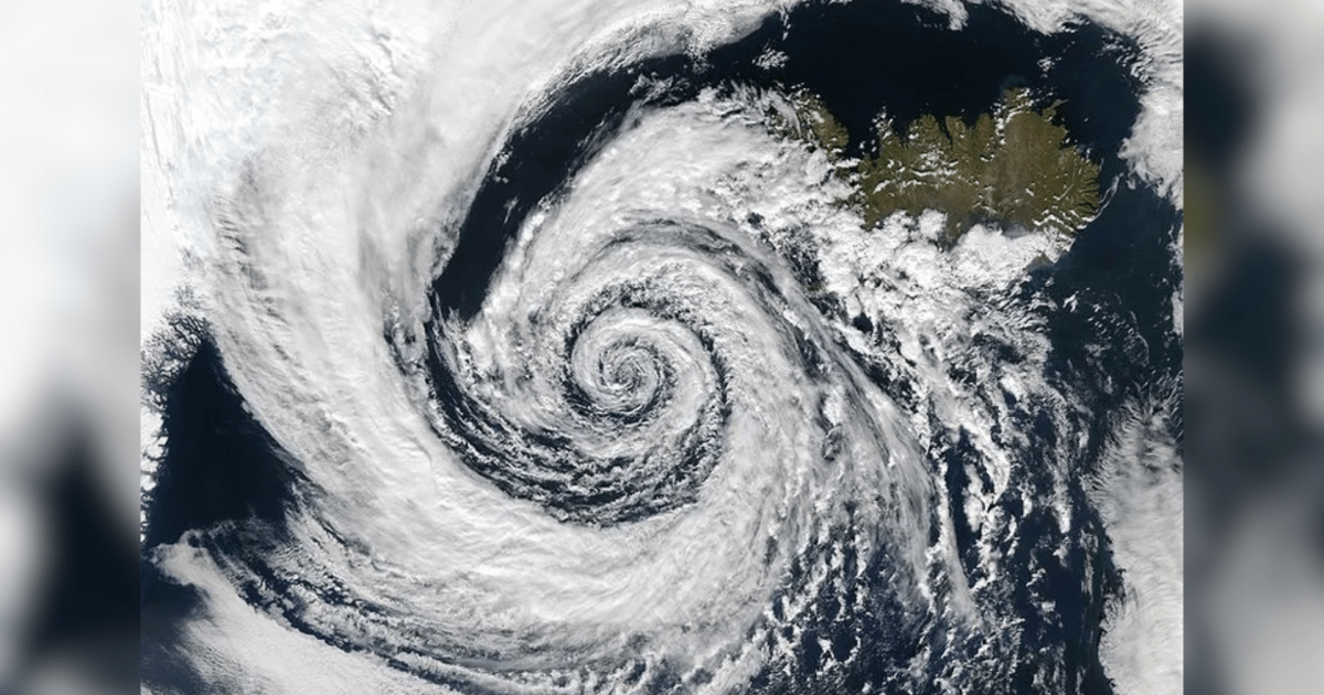
Residents across the South, Southeast, and Center-West regions of Brazil were placed on alert between Thursday, August 6, and Friday, August 7, as a powerful bomb cyclone formed along an advancing cold front. The storm system is expected to trigger heavy rainfall, hail, a sudden drop in temperature, and wind gusts exceeding 100 km/h in certain areas, with the southernmost state of Rio Grande do Sul anticipating the most severe impact.
Brazil's National Institute of Meteorology, known as Inmet, stated that it is not yet possible to confirm whether the bomb cyclone was directly caused by the El Nino climate phenomenon. However, the federal agency explained that El Nino, a natural climate pattern characterized by the periodic warming of surface waters in the central and eastern Pacific Ocean, creates atmospheric patterns that make severe weather events more likely across southern Brazil.
According to Inmet, accumulated rainfall recorded in July was above average across Brazil's Southern region, a behavior considered typical during El Nino years. Meteorologists noted that this elevated rainfall increases moisture availability in the atmosphere, creating conditions that favor the formation of intense weather systems.
Despite these patterns, Inmet emphasized that there is no proven direct cause-and-effect relationship between El Nino and the formation of this specific bomb cyclone. The institute clarified that atmospheric conditions associated with the phenomenon simply make the environment more propicious to the development of storms and other extreme events.
Atmospheric mechanisms of extratropical cyclones
Explaining how bomb cyclones form, Professor Micael Cecchini from the Institute of Astronomy, Geophysics and Atmospheric Sciences at the University of Sao Paulo, Brazil's flagship public research institution, said a cyclone is a large-scale weather system spanning hundreds or even thousands of kilometers. Cecchini explained that cyclones are characterized by organized wind circulation around a central region of low atmospheric pressure, rotating clockwise in the Southern Hemisphere due to the influence of Earth's rotation.
Cecchini noted that cyclones hitting Brazil belong to the extratropical category, which form at higher latitudes outside the tropics where contrast between warm and cold air masses is most pronounced. Unlike tropical cyclones that draw energy from warm ocean waters, extratropical systems derive their main fuel from this thermal contrast between air masses.
When a mass of very cold air advances beneath a significantly warmer air mass, a strong horizontal temperature gradient is established. Cecchini said this thermal contrast intensifies air currents at high atmospheric levels and accelerates the fall in pressure near the Earth's surface.
Differences between standard and bomb cyclones
The speed of that pressure drop is precisely what distinguishes a standard extratropical cyclone from a bomb cyclone. Cecchini explained that meteorologists classify systems as bomb cyclones when they undergo extremely rapid pressure drops and intensification, resulting from an exceptionally sharp temperature contrast between air masses. The greater the temperature difference, the more vigorous the atmospheric circulation becomes and the more severe the associated ground-level weather tends to be.
This thermal difference triggers a chain reaction in the atmosphere as the denser cold air pushes under the warm air mass, forcing the warm air to ascend rapidly. As the warm air rises, it cools and water vapor condenses, fostering the growth of clouds with large vertical development and severe storm cells.
Consequently, the process increases the likelihood of intense rainfall, electrical discharges, hail, and very strong wind gusts. Meteorologists noted that following the passage of the cold front, regions in the storm's path routinely experience a sharp drop in temperatures.


