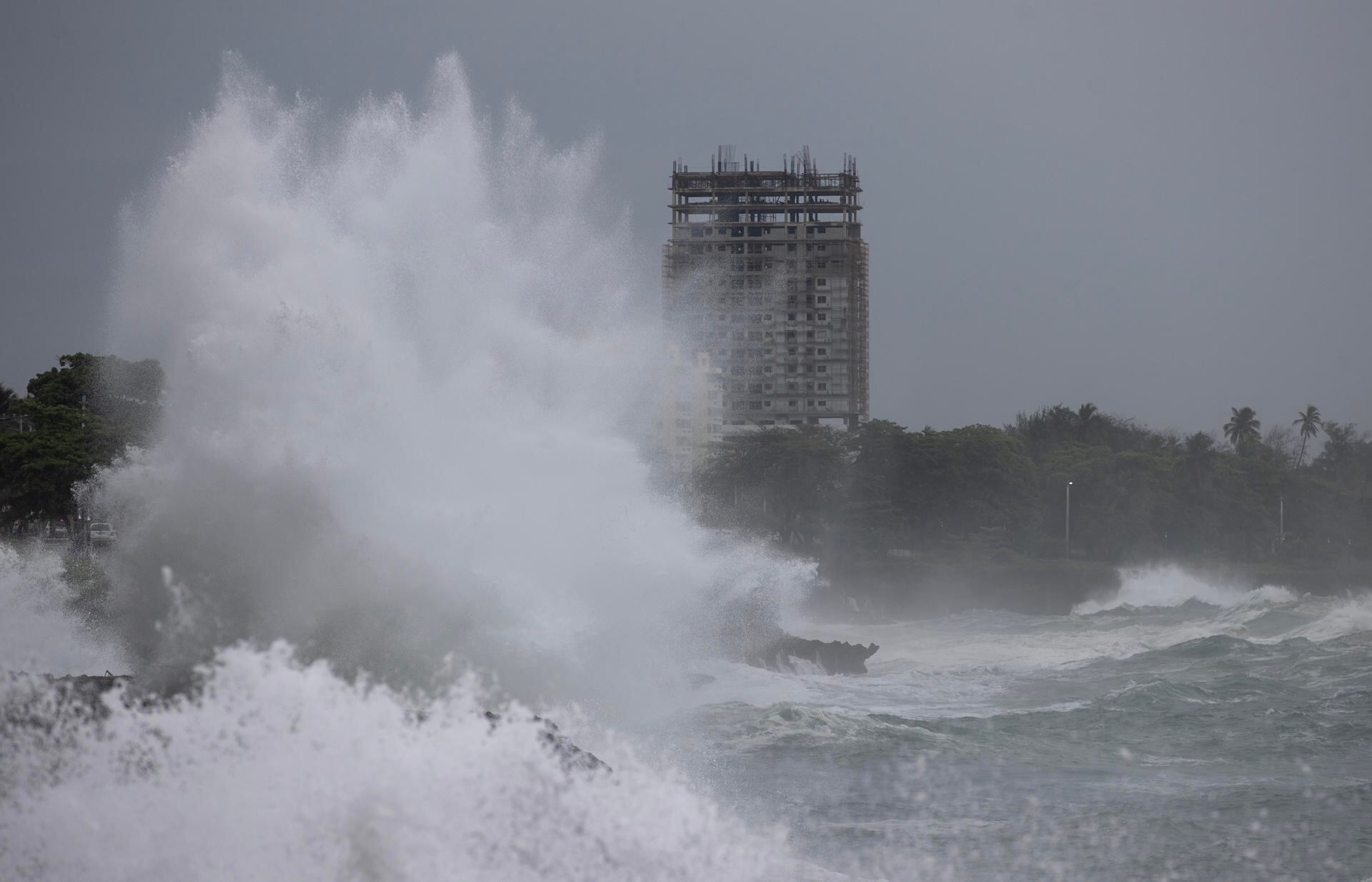
The explosive growth of the Hurricane Beryl, which has become an unprecedented storm, shows that the Atlantic and the Caribbean are in a critical situation, and the type of season that can be expected, according to experts.
This hurricane broke several records even before its hurricane-force winds approached land. The powerful storm is acting more like the monsters that form at the peak of hurricane season, thanks largely to water temperatures currently as high — or higher — than those the region typically reaches in September.
Beryl set the record for the earliest Category 4 storm of the season with winds of at least 130 mph (209 kph), the first Category 4 storm ever recorded in a June month. It was also the earliest storm to have explosive growth, with winds intensifying by 63 mph (102 kph) in 24 hours, going from an unnamed depression to a Category 4 hurricane in 48 hours.
Beryl is following an unusually southerly path, especially for a major hurricane, said Kristen Corbosiero, an atmospheric scientist at the University at Albany.
It made landfall on Carriacou island on Monday with winds of up to 150 mph (240 kph), just shy of a Category 5 storm, and is expected to batter islands in the southeastern Caribbean.
“Beryl is incredibly strange,” said Weather Underground co-founder Jeff Masters, a former government hurricane meteorologist. “It’s so unrelated to the weather that you look at it and say, ‘How could this happen in June?’”
Get used to it. Meteorologists predicted months ago that it would be a tough year, and now they are comparing it to the record-breaking 1933 and the deadly 2005, the year of Katrina, Rita, Wilma and Dennis.
“This is the kind of storm we expect this year, these atypical things that happen when and where they shouldn’t,” said Brian McNoldy, a tropical climate researcher at the University of Miami. “Not only will things form and intensify and reach higher intensities, but the likelihood of rapid intensification will increase. All of that is coming together right now, and it won’t be the last time.”
Phil Klotzbach, a hurricane researcher at Colorado State University, called Beryl “a potential harbinger of more interesting things to come. It’s not that Beryl isn’t interesting in itself, but it may be a sign that there will be more threats and more storms of this kind ahead – and not just one, but several.”
Water temperatures around Beryl are 1 to 2 degrees Celsius (2 to 3.6 degrees Fahrenheit) above normal, at 29 C (84 F), which “is great if you’re a hurricane,” Klotzbach said.
Warm water fuels the storms and clouds that form hurricanes. According to Corbosiero of the University of Albany, the warmer the water and therefore the air at the bottom of the storm, the more likely it is to reach higher in the atmosphere and create deeper storms.
Sea surface temperatures in the Atlantic and Caribbean “areare above what the average temperature of September (the peak of the season) should be, taking into account the average of the last 30 years“Masters said.
It’s not just warm surface water that matters. Ocean heat content — a measure of the deeper water that storms need to continue feeding — is well above record levels for this time of year and what the September peak should be, McNoldy said.
“So when you get all that thermal energy, you can expect some fireworks,” Masters said. This year, there is also a significant difference between water and upper air temperatures in the tropics.
The greater that difference, the more likely storms are to form and the larger they are, said Kerry Emanuel, a hurricane expert at the Massachusetts Institute of Technology.“It’s the warmest I’ve ever seen the Atlantic relative to the rest of the tropics,” he claimed.
Atlantic waters have been unusually warm since March 2023 and have been record-breakingly warm since April 2023. Klotzbach said a high-pressure system that normally sets up trade winds collapsed then and has not returned.
Corbosiero noted that scientists are debating what exactly climate change does to hurricanes, but have reached a consensus that it makes them more likely to intensify rapidly, as Beryl did, and that it increases the number of stronger storms, like Beryl.
According to Emanuel, the slowing of Atlantic ocean currents, likely caused by climate change, may also be a factor in warming waters.
The arrival of La Niña, a slight cooling of the Pacific that changes the climate around the world, may also play a role. Experts say that La Niña tends to reduce the high-altitude crosswinds that kill off hurricanes.
La Niña also typically means more hurricanes in the Atlantic and fewer in the Pacific. The eastern Pacific saw no tropical storms in May and June, something that has only happened twice before, Klotzbach said. Overall, this may be a below-average year for tropical cyclones, except in the Atlantic.
On Sunday night, Beryl underwent an eyewall replacement, which typically weakens a storm as it forms a new center, Corbosiero said. But the storm has now regained strength. “This is our worst-case scenario,” he said. “We’re getting off to an early start, with some very severe storms… unfortunately, it looks like it’s playing out the way we had anticipated.”
It may interest you
- Latin America and the Caribbean build bridges to combat the water crisis
- Atlantic hurricanes: US prepares for frequent and devastating cyclones
- The upcoming Atlantic hurricane season could be the worst in decades
Source: Gestion
Ricardo is a renowned author and journalist, known for his exceptional writing on top-news stories. He currently works as a writer at the 247 News Agency, where he is known for his ability to deliver breaking news and insightful analysis on the most pressing issues of the day.


