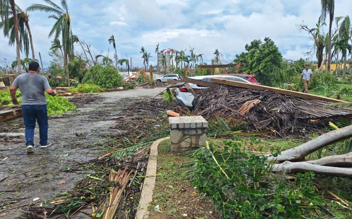
He Hurricane Otis caused at least 27 deaths and serious damage when it hit the coast of the city of Acapulcoin Mexicoas category 5, according to officials.
The speed with which Otis intensified took the government and meteorologists by surprise, leaving little time to issue warnings and prepare for its arrival.
Why was Otis so devastating?
“The way Otis stepped up was very exceptional. He practically broke records in a way”said Michael Brennan, director of the National Hurricane Center (NHC), based in Miami.
In a matter of hours, Otis strengthened from a tropical storm to the most powerful category on the Saffir-Simpson scale before making landfall in the early hours of Wednesday.
Otis “intensified explosively” with peak wind speeds that increased by 185 kilometers per hour in a 24-hour period, according to NHC, which issued storm forecasts and warnings.
Otis recorded maximum sustained winds of 265 kilometers per hour when it hit the coast, the NHC said.
The World Meteorological Organization described the hurricane as “one of the fastest-intensifying tropical cyclones on record,” only surpassed in the current era by Hurricane Patricia in 2015.
Why did Otis escalate so quickly?
“Unfortunately Otis was able to take advantage of the favorable conditions”including warm, deep waters and a favorable atmospheric environment, Brennan said.
“The storm was able to develop an internal core and structure that allowed it to take advantage of those favorable conditions and the environment in the ocean, as well as the atmosphere, to rapidly intensify.”said.
Although hurricanes hit Mexico every year on the Pacific and Atlantic coasts, usually between May and November, few make landfall as Category 5 hurricanes.
“There is no record of hurricanes even close to this intensity in this part of Mexico”the NHC had said as Otis approached the Mexican coast, warning that “a nightmare scenario” was unfolding.
Is climate change to blame?
The water temperatures off the Mexican coast that Otis found were 30 to 31 degrees Celsius, Brennan said.
“It may be a little warmer than usual, but not too much. “That area is usually quite warm and has very deep and warm ocean waters at this time of year.”he added.
“So it’s difficult to necessarily attribute that particular aspect to climate change or global warming. We’ll have to look back and do some studies,” Brennan said.
Will global warming bring more devastating storms like Otis?
Brennan said that “The science on the subject is not very settled at the moment.”
“There are some studies that suggest that rapid intensification is becoming more common in a hot climate,” Indian.
“We are very confident that the impacts of hurricanes from heavy rain, flooding and storm surge are getting worse in a warming climate and will continue to get worse as the climate warms.”he added.
This is due to rising sea levels, which cause more dangerous storm surges and a warmer atmosphere that retains more moisture, which in turn leads to more intense rainfall, Brennan explained.
The UN Intergovernmental Panel on Climate Change (IPCC) stated in 2021 that the proportion of particularly intense cyclones (categories 4 and 5) should increase by 10% compared to the pre-industrial era, with warming of +1.5 degrees Celsius , a 13% at +2 C. and in a 30% at +4C.
According to the IPCC, as a result of rising sea levels and flooding, more than one billion people will live in coastal cities at risk by 2050.
Source: AFP
Source: Gestion
Ricardo is a renowned author and journalist, known for his exceptional writing on top-news stories. He currently works as a writer at the 247 News Agency, where he is known for his ability to deliver breaking news and insightful analysis on the most pressing issues of the day.


